New Resource Helps Almond Growers Pinpoint Yield
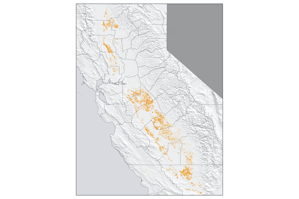
Statewide distribution of almond orchards in California in 2018. (Photo: Land IQ)
With 80% of the global almond supply coming from California, having accurate information is crucial for the entire industry. Therefore, in 2010, when California almond growers and the Almond Board of California (ABC) felt that estimates of almond acreage provided by the National Agricultural Statistics Service (NASS) were too low, they sought out an innovation from Land IQ — an agricultural research company based in California that combines land-based agricultural science with spatial technology to offer innovations for agricultural challenges.
Land IQ responded in kind by developing the California Almond Industry Map (CAIM). When creating this tool, the scientists at Land IQ first wanted to ensure the almond acreage being reported was accurate. To do this, they obtained a variety of images through remote sensing, such as satellite imagery. The images were defined by the crop types shown, then validated by ground truthing.
This involved three researchers, who drove thousands of miles around California, identifying crops and collecting location data. Using both the remote sensing and ground sensing data, Land IQ trained computer algorithms to identify almond acreage. Finally, the researchers tested the computer algorithms’ ability to classify orchards that the researchers knew were almonds as a result of their ground truthing. Validation proved the tool to be 98.8% accurate in identifying almond orchards. With the almond acreage data in hand, Land IQ proved that previous acreage estimates were at least 10% too low.
“We wanted to get the acreage right in the first place, then integrate age, location, and environmental and water supply variables to develop an accurate almond yield forecasting tool,” Joel Kimmelshue, Land IQ Owner and Principal Scientist, says.
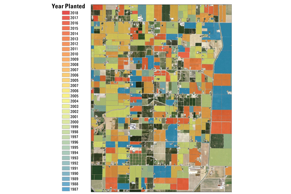
Zoomed-in quadrant of California almond orchards with age of orchard designated by color in 2018. (Photo: Land IQ)
Young Trees Challenging
Determining an orchard’s age is easier once orchards are three years or older and gain a distinctive canopy. However, at one or two years, the computer software finds it hard to differentiate between trees of different types. Much of the data for non-bearing acreages comes from experience and ground truthing rather than imagery. However, by noting the identity of young orchards while on the ground, hopefully computer algorithms can learn better in time.
Understanding almond acreage numbers helps provide more confidence and can help in making decisions about marketing, processing, or regulatory actions. Kimmelshue says he hopes with the help of the CAIM that “people can stop wondering and speculating on acreage numbers and instead use the information to make informed decisions about their crops.”
Helping to make better-informed decisions is the Almond Yield Forecasting Tool (AYFT), which takes into consideration orchard acreage, age, location, and environmental conditions to forecast yield.
“Looking at acreage from past and current years is helpful from a regulatory perspective, especially since we know it’s accurate,” Jesse Roseman, Senior Environmental Specialist with ABC, says. “By overlaying the data with political districts, groundwater data, and irrigation districts, we can answer questions that are of interest to many parties.”
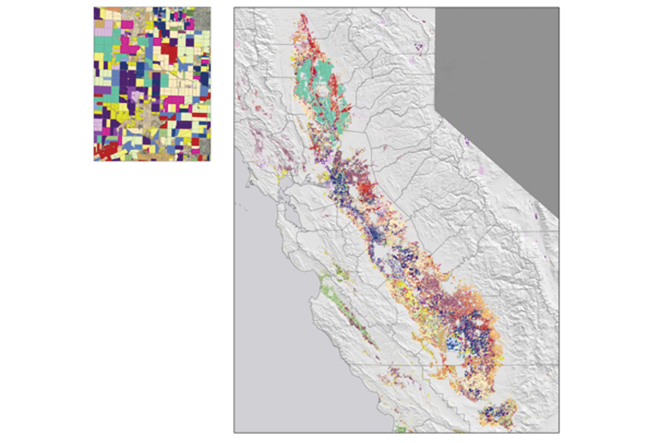
Statewide crop distribution in California, 2018. Land IQ maps more than crop types and land uses. Inset: zoomed-in crop distribution quadrant. (Photo: Land IQ)
Numerous Applications
Some regulatory and industry applications include groundwater recharge, air quality, and pesticide buffers. Since water availability is a perennial challenge facing growers in California, the CAIM allows growers to account for their water supply impacts at county, region, and state levels. The data generated by the maps have been used by third parties such as the Flood Management Aquifer
Recharge, and have helped spark further discussion about how working almond orchards can play a role in water sustainability plans.
“Having it [the map] geographically available and extremely accurate is useful in many ways, though we didn’t know all of the potential applications when we set out,” Roseman says, but he hopes that growers can “get a wider perspective on where other acreage is in relation to their fields, whether it’s unfamiliar or familiar, and the knowledge can build a common understanding.”
The technology used to create these maps isn’t only helpful for almond growers, however. Land IQ has completed and is continually expanding statewide mapping for other nut crops in California such as walnuts, pistachios, and pecans and is beginning this process throughout the U.S.
“We’ll never try to replace NASS, but we hope that our tools can complement the work done by NASS,” Kimmelshue says.
While analysis of the maps is available to anyone via the ABC, the CAIM is also available online, putting the decision making in the hands of those who have their feet on the ground in orchards. From a starting point of trying to determine the accurate acreage of almonds in California, Land IQ and ABC are helping the almond industry answer the tough questions that face an ever-shifting agriculture climate.
